")


CERES through Russian inner waterways (part one)
Thierry J.-L. Courvoisier
Cérès, our 40ft Centurion 40S, had been staying for some years in the Baltic sea. We had sailed the along its South coast (Poland, the Baltic states) and in the Finnish archipelago, enjoying the history of the region and nature in the Finnish archipelago (see Flying Fish 2014-2 and 2016-1). With Cérès in Helsinki during the 2015-16 Winter, Barbara and I wondered whether we could exit the almost closed water system of the Baltic Sea while discovering new territories. Some years earlier, we had enjoyed a few Winter days in Tromsø, the large Norwegian city at 70°N with an important university, and found the light of the arctic Winter fascinating. That could be an interesting place to spend some more time and possibly a place for me to obtain a visiting position in an institute of the university! I developed contacts in the Arctic University in Tromsø and arranged an academic stay as invited professor for the Winter semester 2016-2017.
Looking at a European chart one sees that the most natural route between the eastern part of the Baltic sea and the Norwegian Sea leads along the east of the Scandinavian peninsula, via Saint Petersburg, the great Russian lakes, the Belomorsk canal, the White Sea, and up the Barents sea to the northern tip of the European Continent, from where one moves South again to Tromsø. Some elements of family history related to Peter the Great and the origin of the Russian northern fleet added to the attraction of sailing this path. The route, without being exactly among the most popular cruising itineraries, has been sailed a few times in the last years, including by Chamade in 2012 and by Jarlath Cunnane, (Flying fish 2013/1).
The OCC maintains a presence in Saint-Petersburg through a port officer, Vladimir Ivankiv. Vladimir is spending considerable effort opening the Russian waters to cruising activities. He does so for the Russian part of the Baltic sea, but also aims at making the route to the Barents sea accessible to foreign ships. Contacts with him in the months preceding our passage paved the way to obtaining the necessary visas and authorisations to sail the Russian inland waterways. Vladimir provided the required invitation and informed us of the conditions of the Russian authorities to undertake the voyage. These conditions include in principle that a pilot sails along for the whole passage. This requirement is interpreted lightly for sailing boats and translates into the requirement that we have one Russian crew member. We thus looked for and found a young student from Arkhangelsk, Masha, who took this opportunity to discover part of her country and culture. Masha is a French and English translator, a perfect combination for our French speaking crew. Masha’s presence proved indispensible, as contacts with all sorts of authorities along the route were to be numerous, be it only to operate bridges and locks, and none of them were familiar with English.
Professional duties made it impossible to leave Helsinki before July 10, well after the Summer solstice, on a Summer day that started in as heavy a fog as one can imagine. We left the harbour as soon as the visibility was sufficient to cross safely the heavy ferry traffic between Tallin and Helsinki. Winds settled from the West for the next several days, making for a few pleasant sailing days to Kotka, the last Finnish city before the Russian border.
Before entering the Russian waters one must clear out of the European Union. This is done in Haapasaari, a small island 15 NM from Kotka where Finnish officials do the paperwork efficiently. The Russian authorities had to be informed of our approach 24h in advance, which Vladimir did. The Finnish officers clearing us out also informed their Russian colleagues of our impending arrival in their waters. We had been instructed to cross the Finnish-Russian border at the special mark “number 16” and to call the Russian coast guards on channel 16 shortly before reaching the mark. Our call remained unanswered, but we proceeded nonetheless, noting that administrative procedures do not imply any change in the conditions of the water we were sailing on.
There are still some 80M from there to sail eastwards in the golf of Finland before reaching Kronstadt, the small city on an island another 20 NM from Saint-Petersburg. We left Haapasaari in the late afternoon with the last of the westerlies and sailed through a night of absolute calm lit by the beautiful colours of a sunset that ends in a sunrise. The strong and rainy easterlies that had been predicted reached us just few NM before Kronstadt, ensuring a cold and wet arrival in our first Russian stop. Dykes extend from both coasts of the gulf to the island, leaving only a narrow opening in front of Fort Konstantin, just outside the city. Heavy doors can be seen on either side of the passage. They are meant to be closed when weather conditions cause a surge of the water level in the eastern part of the Baltic sea that could threaten Saint-Petersburg.
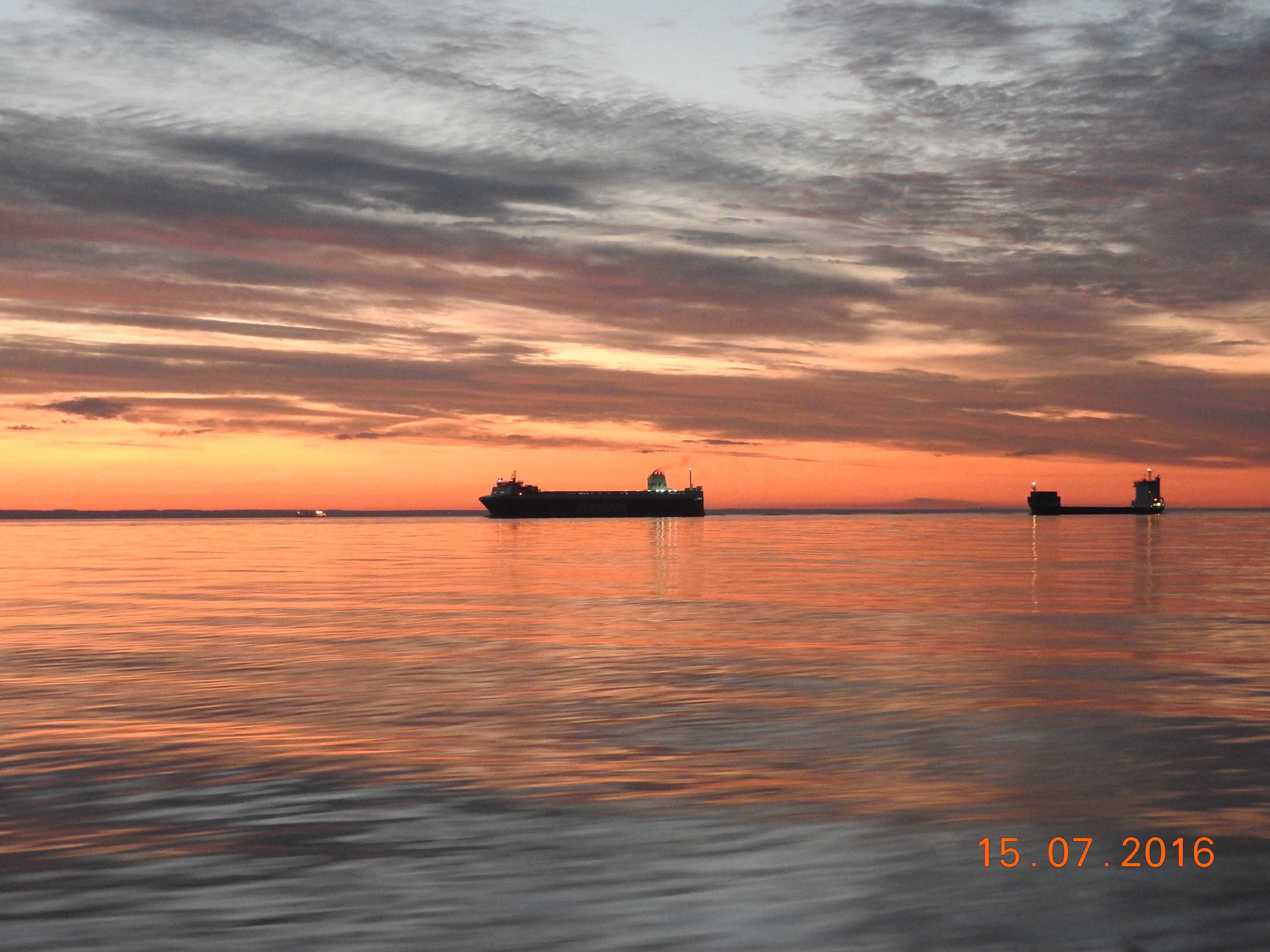
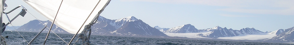
Fig. 1 Sailing eastward on the Russian waters of the Gulf of Finland on the way to Kronstadt.
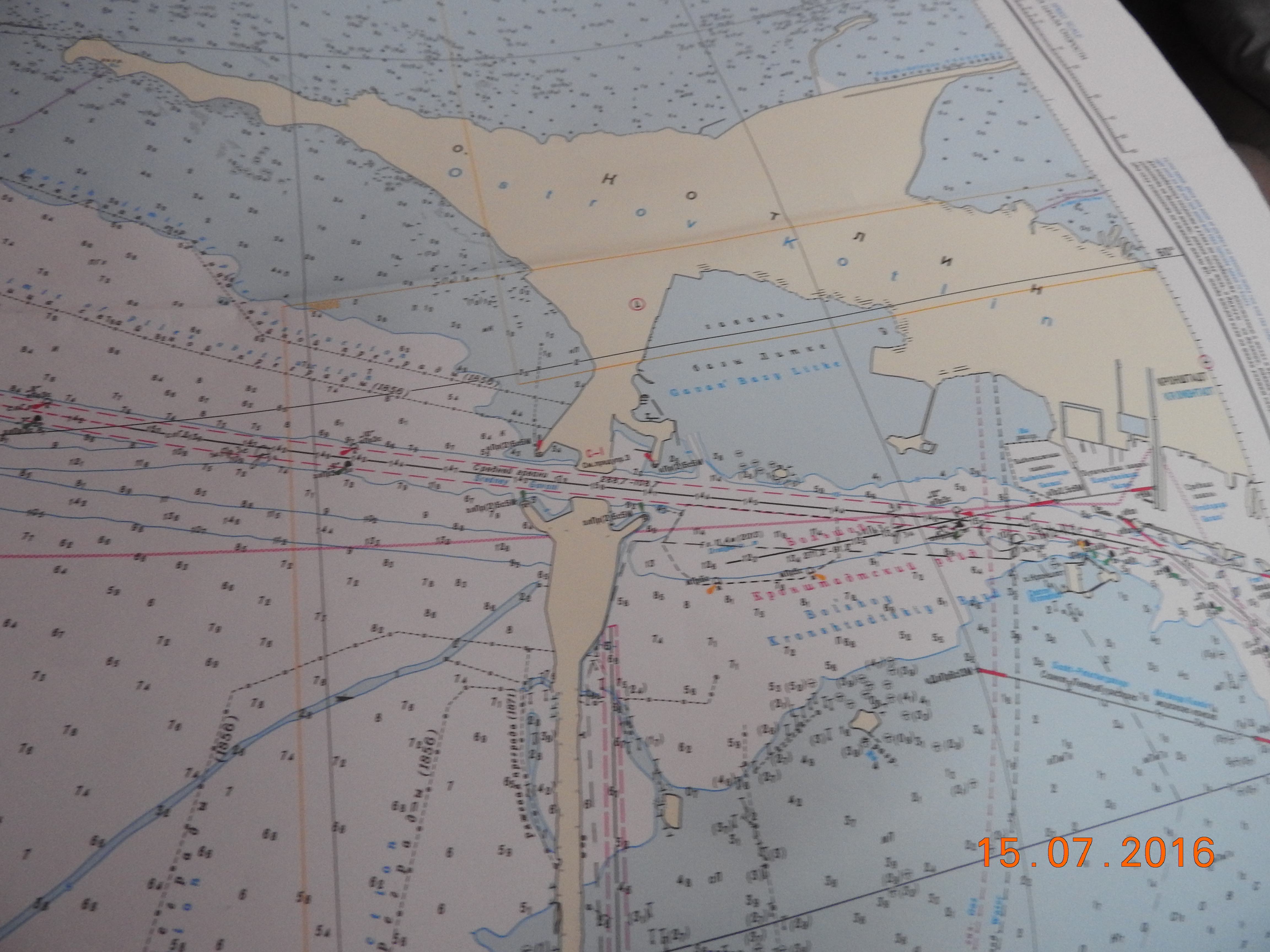
Fig. 2 Approaches to Fort Konstantin and Kronstadt.
The basin of the authorities in Fort Konstantin is small, poorly protected from the east, from where the wind blew, ill equipped to moor a yacht and generally most unpleasant. It was the first of many uncomfortable berths along our route. The entry procedure was somewhat lengthy. The officers were, however, friendly and helpful. Vladimir had given all necessary details about our trip; customs and coast guards had the corresponding forms ready for us to fill. No payment was required. Paperwork done, we tied nearby in Fort Konstantin, where we met Masha, the young Russian lady from Arkhangelsk who was to sail home with us.
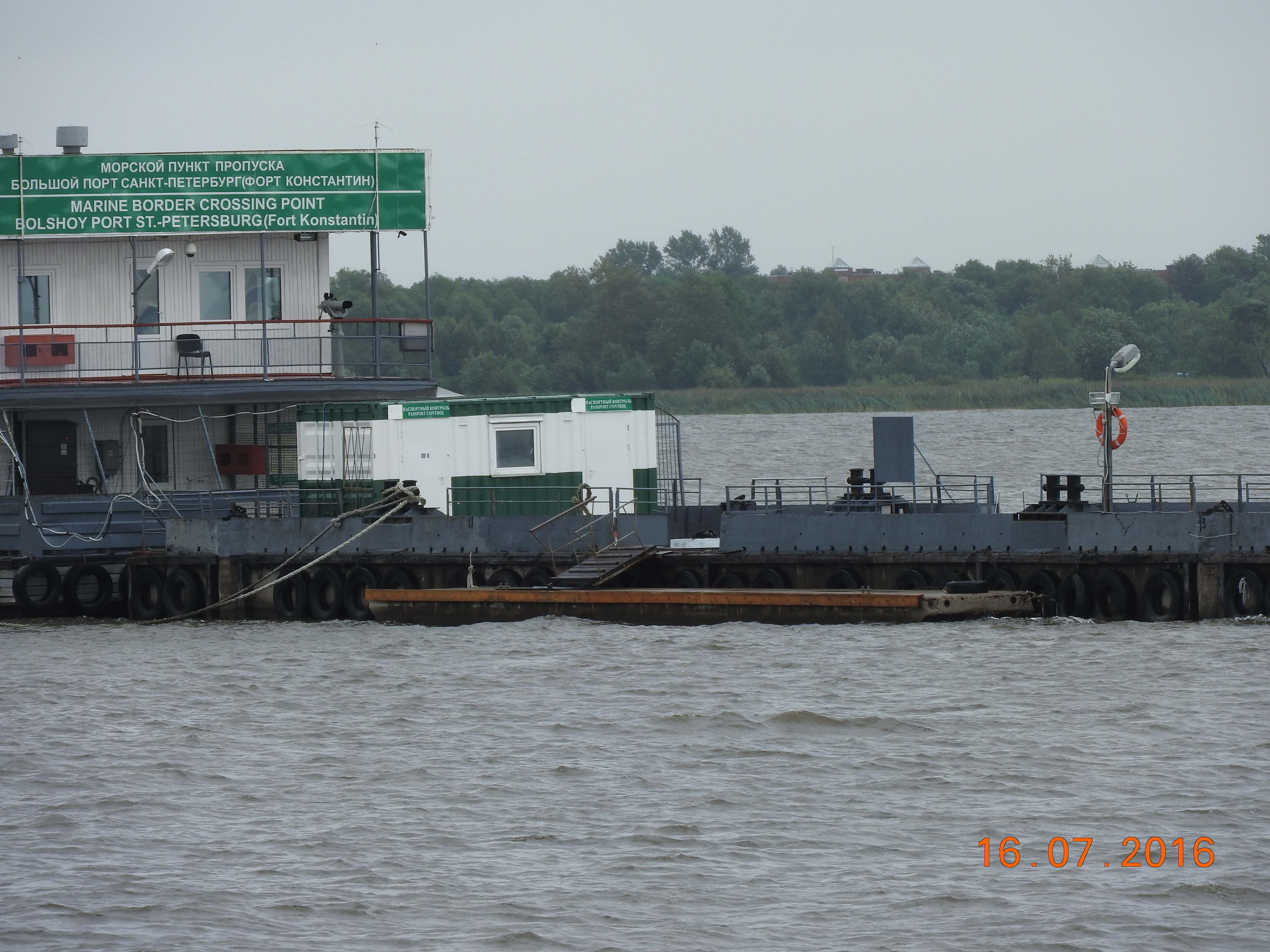
Fig. 3 Basin of the port authorities in Fort Konstantin near Kronstadt.
We visited Kronstadt under pouring rain and the promised strong easterly windsbefore sailing 20 NM the following day to Saint-Petersburg Central River Yacht club. We sailed east and north east on thick brown waters following well marked channels used by a heavy traffic of cargo ships and tourist hydrofoils flashing by in heavy black smoke, in a south west wind of force 4-7 and rain. Vladimir had indicated that we should look for the wall of the harbour when approaching, but rather than seeing the harbour, a bridge under construction was conspicuous on our path. The construction work not being mentioned on any of our charts, we were happy when Vladimir indicated on the phone that we had enough head room to sail under it. This had been the first time Masha had set foot on a sailing boat. The day was moderately enjoyable and did not contribute much to make Masha love sailing.
Our crew was completed in Saint-Petersburg when Nicolas, a friend from Switzerland, met us. Nicolas is an excellent sailor, he was to be on board for our whole journey to Norway.
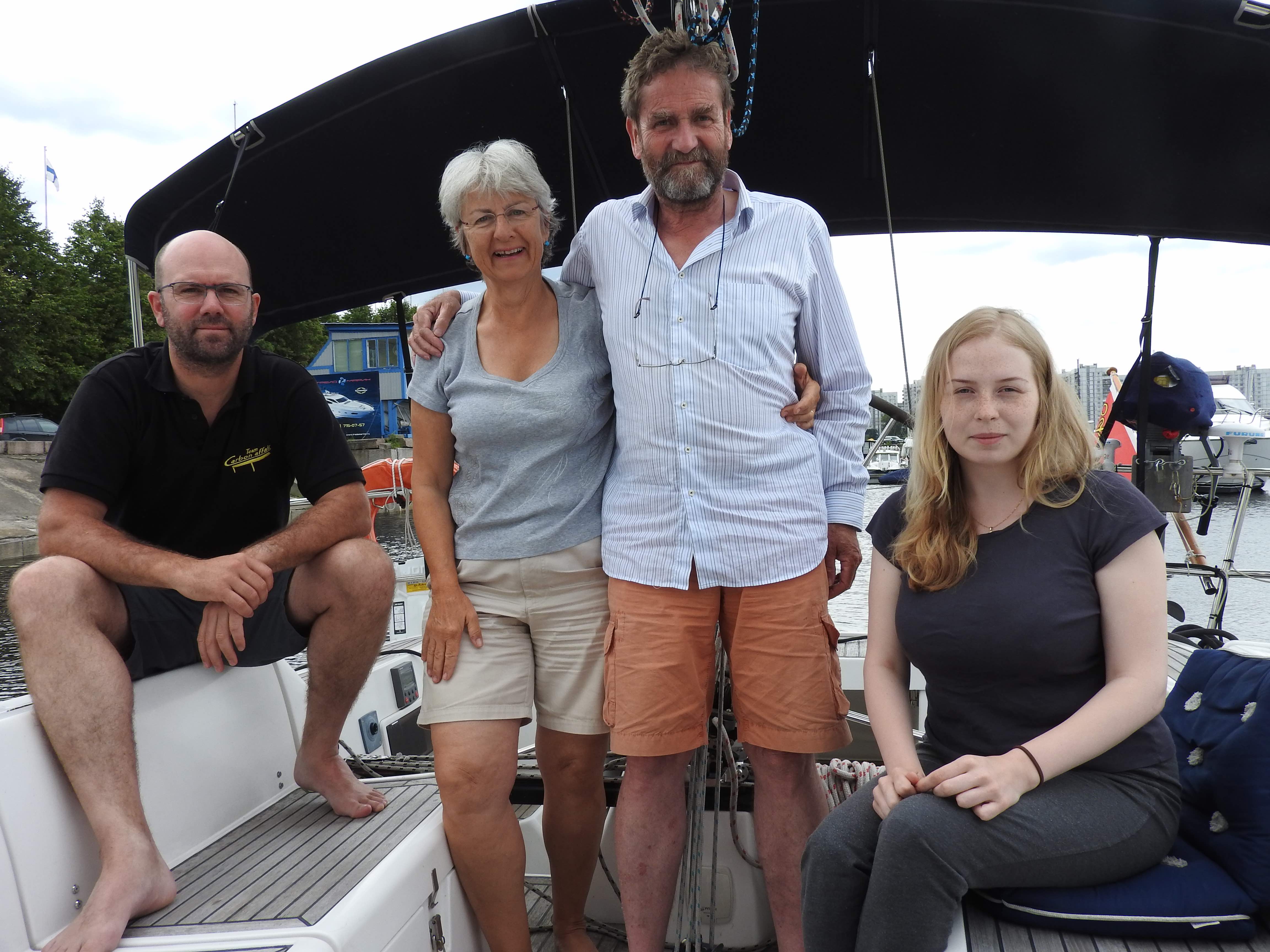
Fig. 4 Cérès’ crew. From left to right, Nicolas, Barbara, Thierry and Masha.
Saint-Petersburg is a wonderful city enjoyed by a tremendous number of tourists. We did visit for a couple days, but concentrated on meeting old friends and preparing for the coming trip. Vladimir provided us with a VHF radio to be used on the inland waterways (frequencies differ from those of the international maritime VHF traffic), verified that we had the required documentation, and that we were able to understand it with the help of Masha. He also gave us a number of contacts along the route. Surprisingly Vladimir did not hand us any document stating that we had paid the dues for the locks, bridges and channels, nor any official passage authorisation papers. He simply stated, and was proven right during the following weeks, that all necessary paper work had been done, authorisations obtained and the required sums paid, and that our passage was expected along the plan we had provided in advance.
The first leg of our journey took place July 20 at 00h00. The mandatory Saint-Petersburg pilot, organised by Vladimir as part of the arrangement, arrived at the boat, as expected. He described the route and procedures to motor through the city bridges before leaving. We let the lines free at 01h00 to be ready when the bridges open at 2am. What a sight! Sliding in front of the lit palaces of the city during the night with a hint of light left in the North and the Moon in the South. At 6am we were motoring up the Neva river in the suburbs of the city, less glamorous, but still in a reasonable shape. We left our pilot on the bank and continued towards the next bridge on our own.
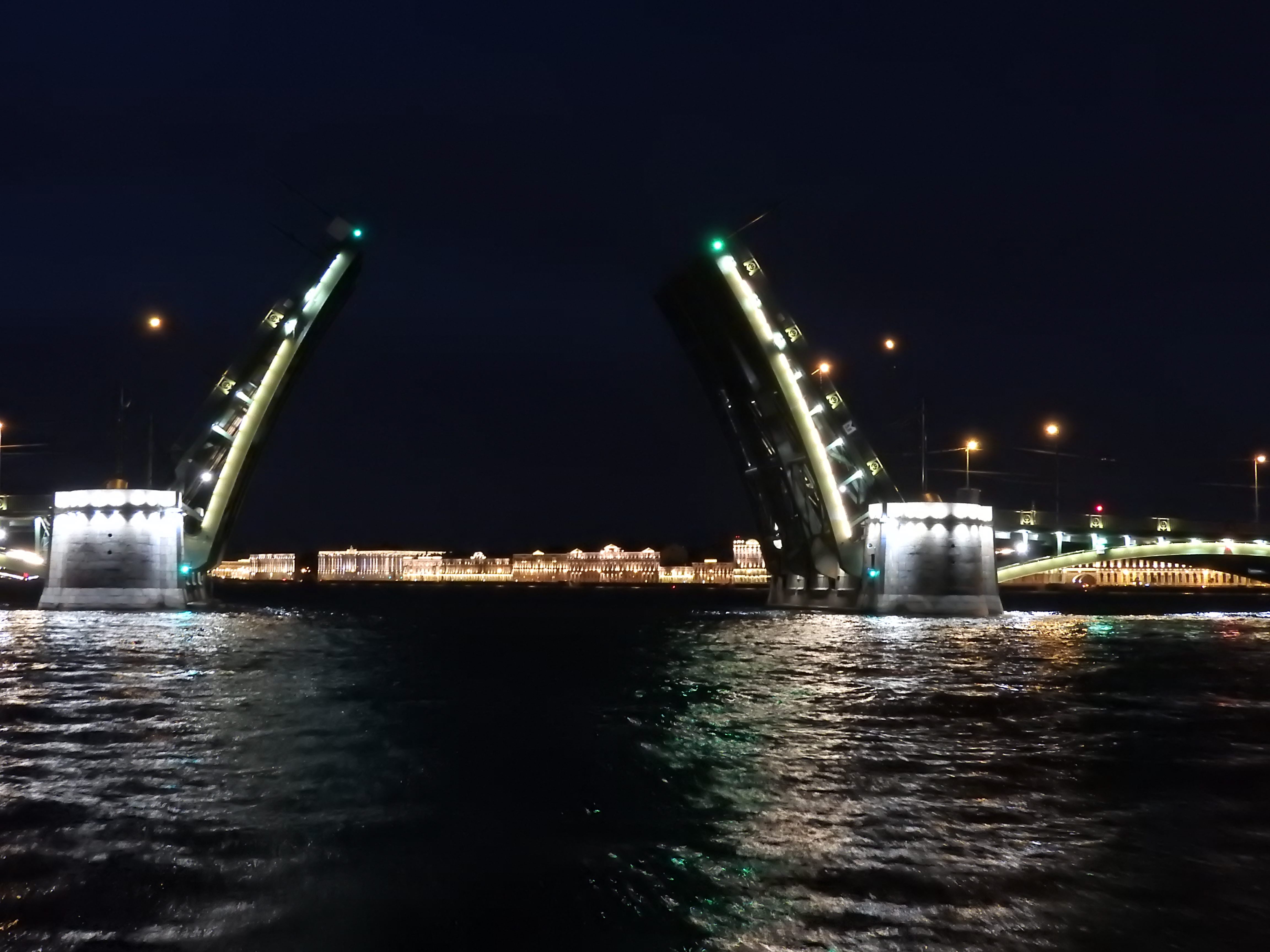
Fig. 5 Bridge open on the Saint-Petersburg palaces
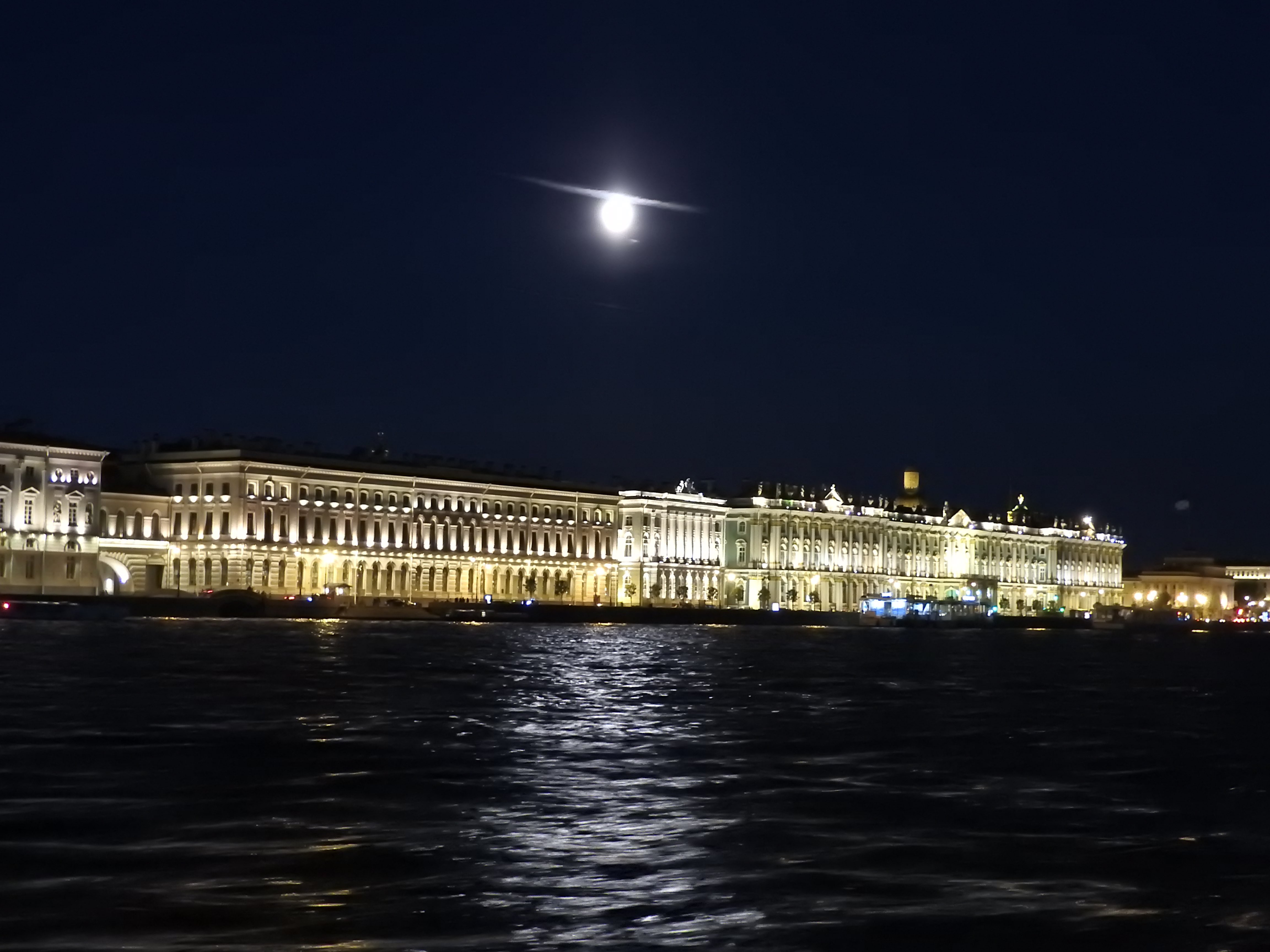
Fig.6 The Ermitage palace as we motor by.
The last bridge on the Neva river before reaching the Ladoga lake in Schlisselburg is a train bridge that opens only between 4pm and 6pm. We had to motor as fast as possible from Saint-Petersburg in order be there in time, sailing against a strong current and a strengthening wind dead ahead. We arrived just in time. Masha established the communication and the bridge opened to the required height, which obviously had been communicated in advance. Arriving in Schlisselburg in cold , rainy and windy conditions that evening was no fun, what looked on the chart as a possible shelter was in fact a derelict dike, no pontoon or quay was to be seen and the port authorities were unhappy to see a yacht arrive without a proper pilot. We were finally directed to a floating crane where we understood we could tie. Lots of rusting steel, but good fenders and lines allowed for a safe berthing in the prevailing conditions. The city was drab. Some of the wooden buildings were partly derelict, others in decaying concrete of the 1960s, a fraction of them abandoned. Trees often grow close to the walls and windows, adding a gloomy touch to the sight. The whole city gave a sad and hopeless impression.
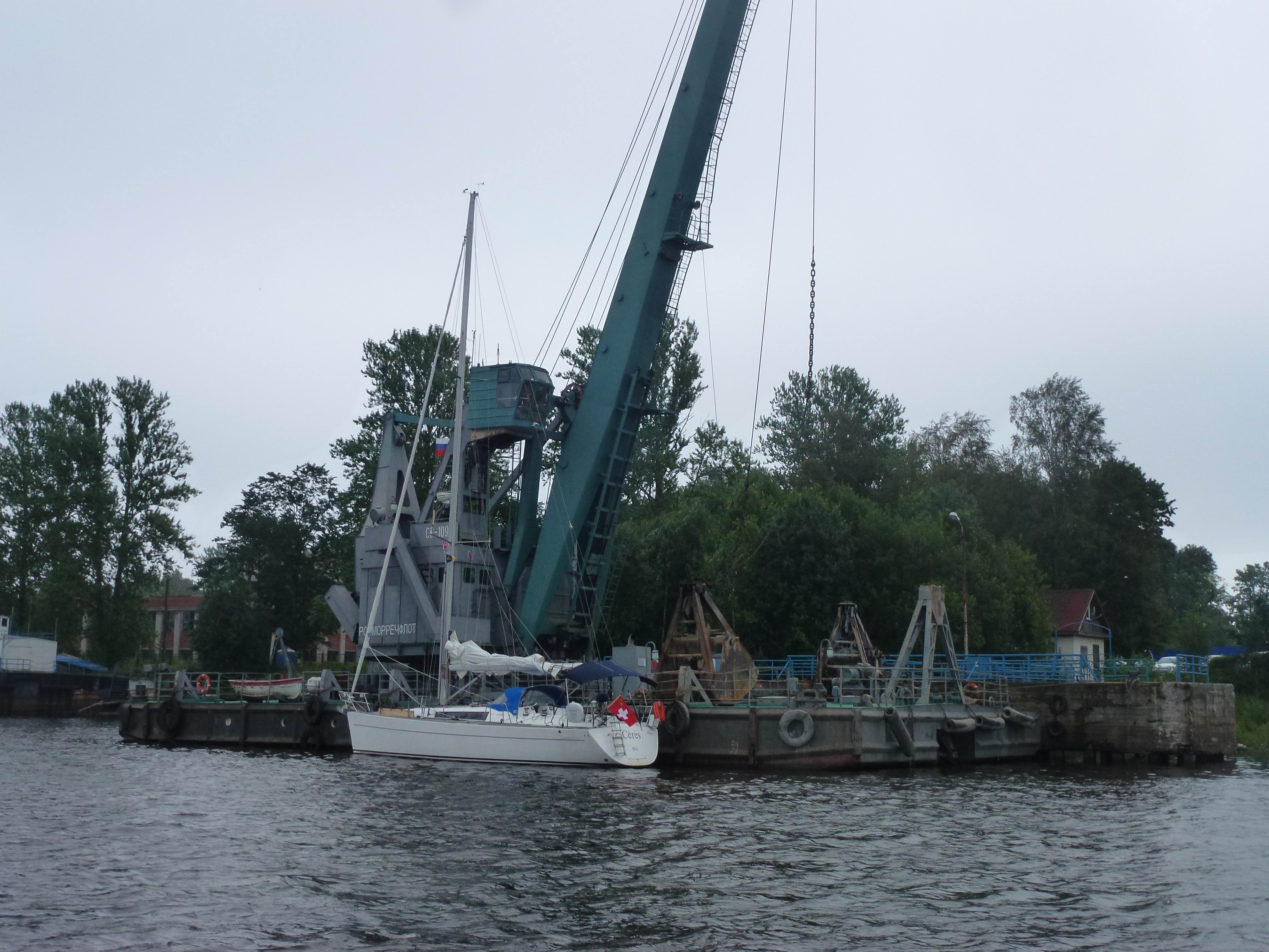
Fig. 7 Cérès moored on a floating crane in Schlisselburg.
The fortress of Oresheck lies on an island two or three NM from Schlisselburg towards the Ladoga lake. No way to go there with Cérès in absence of a place to secure a boat, but there is a service to reach the island. The island has been used as a fortress for many centuries, it was a strongpoint of the Soviet resistance to the Nazi invasion during the Second World war. One of those spots which were key to the Nazi’s defeat in Russia. Reading “Kaputt” by Malaparte gives some idea of war conditions in and around Leningrad and of the suffering and efforts endured by Soviet people during the war. This is remembered in the fortress by a monument in Soviet flamboyant style in the middle of the ruins of the church that once stood at the centre of the fortress. The ensemble of the black monument within the bare red brick ruins is deeply moving. It reminded us that the victory against Nazism is also largely due to Soviet efforts. The Russian orthodox establishment is seemingly battling now to get its hands back on the church. They want to move the monument out of the ruins and rebuild a brilliant church or monastery, which the local people object to. Indeed the present arrangement is a vivid illustration of a time of acute fights to which the whole local population contributed a heavy toll.
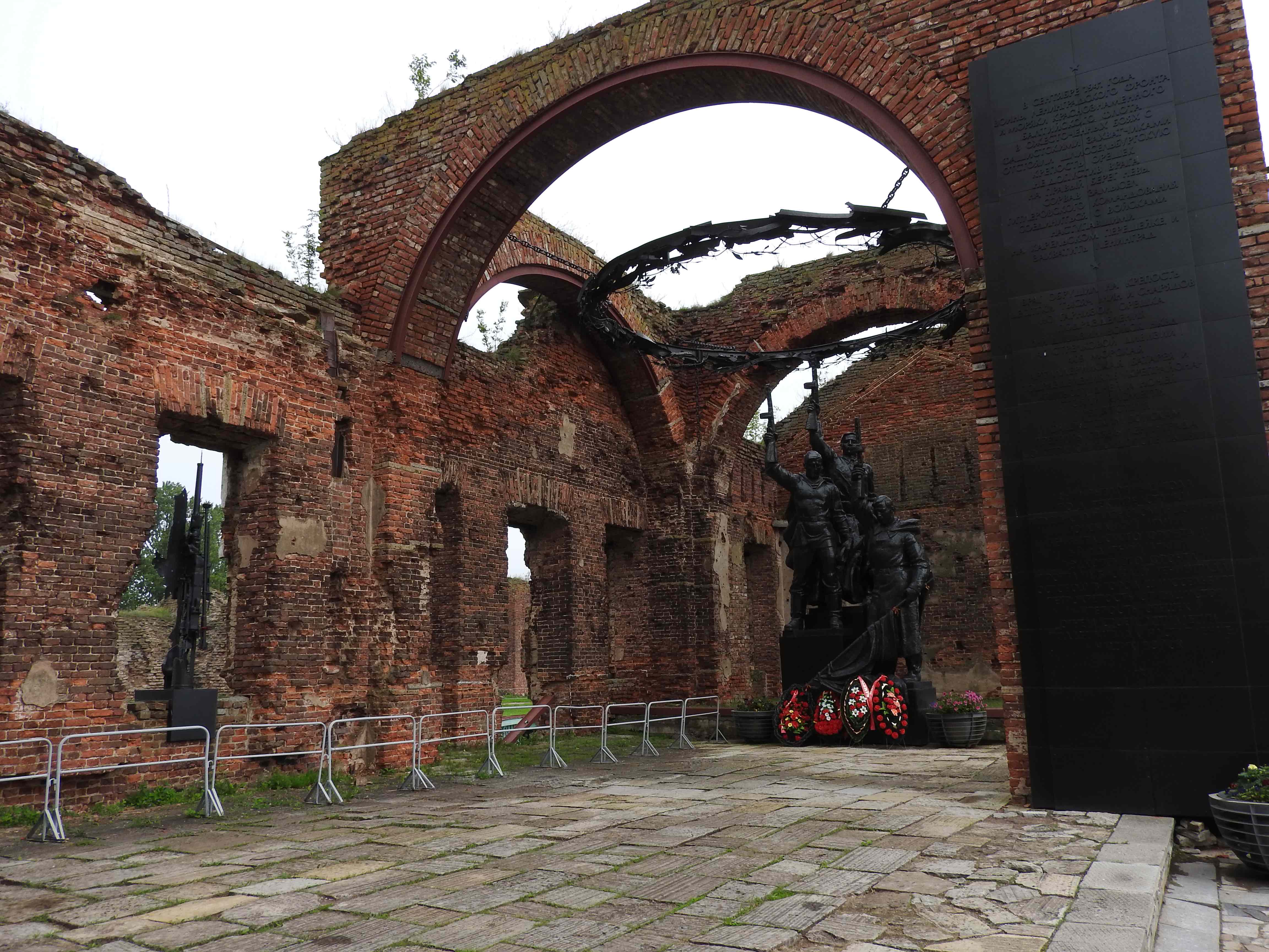
Fig. 8 The monument to the memory of the war efforts in Oresheck
The fortress was also a prison where the tsars deported dissidents, as happened in the 1820s when Tsar Nicholas I exiled there the Decembrists. That part of the detention facilities can be visited. The Soviets kept the tradition of using the island as a prison and developed the detention facility in what must have been ugly practices. Indeed part of it was called “the menagerie” because there were no walls inside, just wired fences, giving detainees no intimacy whatsoever. These deeds are past, the island is now visited by Russian tourists and few from abroad arriving from Saint-Petersburg on fast hydrofoils for a couple hours on site.
The weather the day of our visit to Oreshek was brilliant, the forecast for the next day was not as nice, but did promise some pleasant sailing while moving north on the lake Ladoga. Things were to turn out differently, though. While the sun was up during the preparation of the boat between 6am and 7am, fog appeared just as we were ready to sail off. Radio contacts had warned us that conditions on the lake could be dramatic with an operator questioning us on the maximum wave height that Cérès can tolerate. A somewhat disconcerting question when approaching a lake that is large (more than 100NM), but no ocean and in winds expected to not exceed force 5 or 6. The current around the fortress was strong, around 4knots, making for slow progress in the channel that led to the open waters of the lake. The fog lifted, but rain set in as the wind kept blowing from the North, the direction we were heading to to reach Konievets, an island some 70 NM away. We motorsailed for the first nine hours in the cold and wet weather, but the conditions eased towards the end of the day giving us four hours of sailing close to the wind. As we approached the island from the South in a northerly wind, the conditions became quiet with some wind left under a grey sky on flat waters. The island is home to a monastery, the light blue bulbs of which shone in the grey of the sea and green of the forest as we approached land. We dropped the anchor in 4.5m deep water and enjoyed the endless cool calm of the evening.
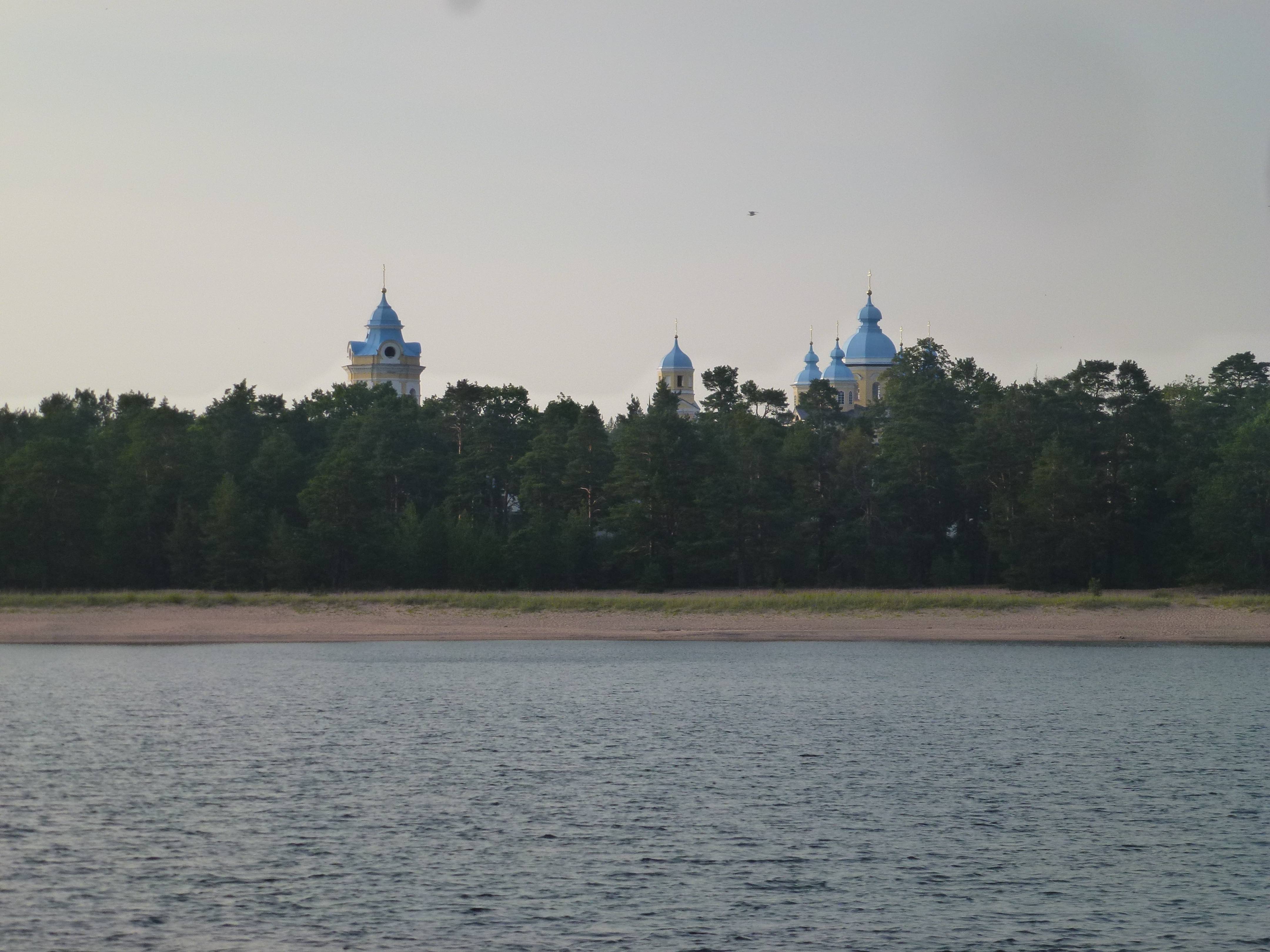
Fig. 9 Arrival in front of the beach in Konievets
Military ships brought a host of people, whom we later identified as pilgrims, to a shabby wooden quay the next morning. We disembarked on the beach using our dinghy and made our way to the monastery. On the beach we were greeted by officials requiring that Barbara and Masha wore skirts and covered their head, while men had to wear long trousers. So equipped we walked to the monastery, an ensemble of buildings around the white church sitting under the blue bulbs. There are two churches in the central building, one on the ground floor, richly decorated and one above in lighter tones. The lower of these spaces can be heated and is used during the Winter, while the top one is used during the warmer months. All the people who had been brought there by the military boats were there, mainly women. A liturgy that seemed to have begun long before our arrival and that was to continue long after our departure was proceeding. Priests and monks were singing in deep and strong voices while parading in rich robes of gold, white and dark colours generously balancing incense smoke towards the standing crowd. We did not understand the meaning of the ceremony, but found the voices and the show beautiful and impressive. It was to be the only time we were to see the singing priests and monks who usually remain hidden behind the iconostasis.
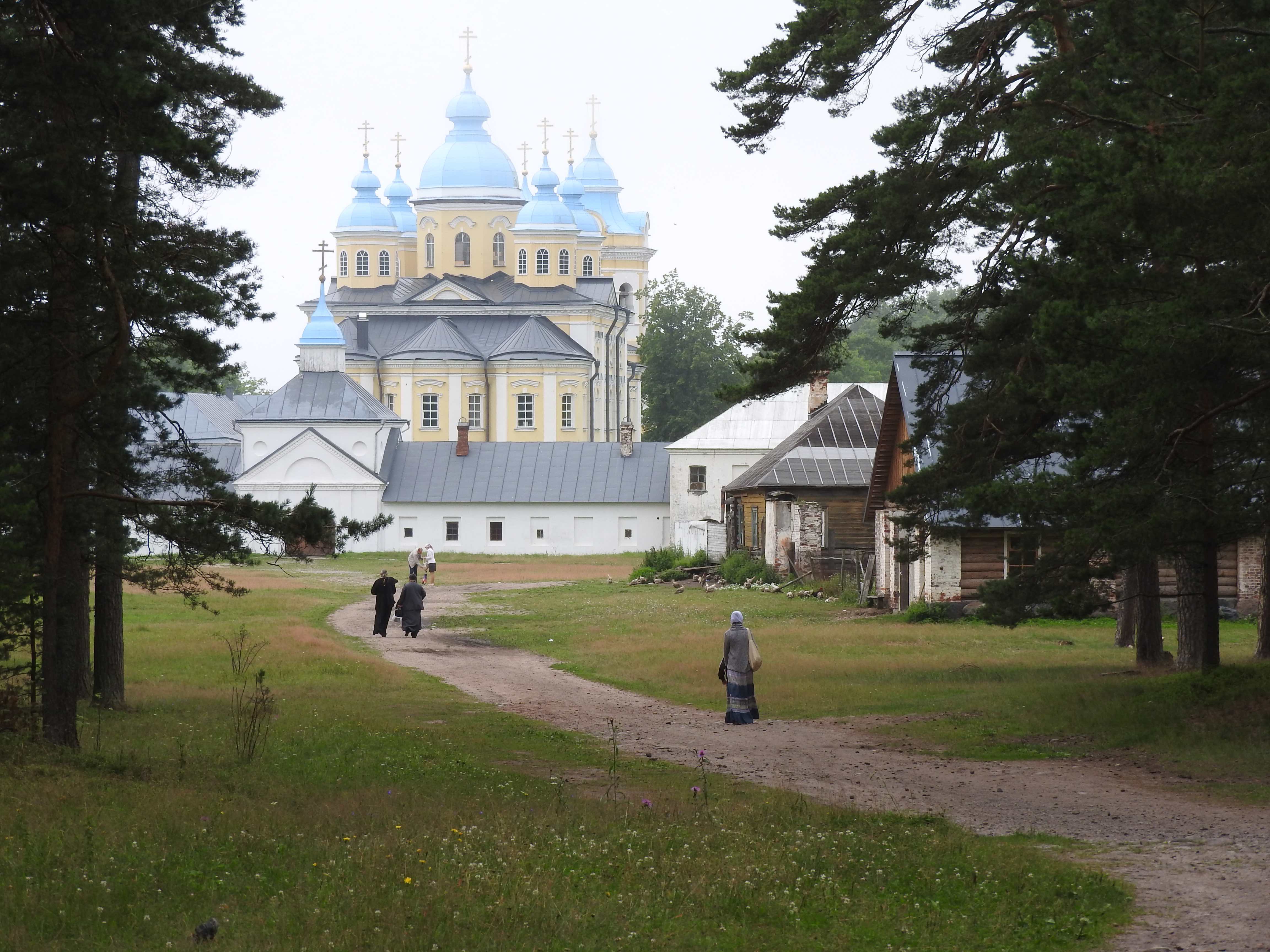
Fig. 10 The Konievets monastery
Our friend Nicolas spends many of his holidays in Russia, most often climbing in exotic mountain ranges. He thus developed a friendship with some young people of Saint-Petersburg, who were spending the Summer camping on the North shore of Lake Ladoga. Since the weather was calm we decided to visit their camp. This caused some stir within the authorities that were following our progress, as it involved an unannounced stop some 30NM from our route, but this seemed manageable for 24h. There were some 30 people camping there, the youngest few months old and the oldest above 80 (years, not months). They were many miles away from the nearest village, road or shop. All had come from the nearest point ,where cars could approach the lake, some nautical miles away by dinghy or kayak, carrying the equipment needed to keep all these people alive, dry and for some of them working for several weeks. The “office” was an open space on a wooden floor and was protected by a tarp. It included a large number of laptops on improvised tables connected by wires winding in all directions. An internet connection provided them with access to the wide world. All the infrastructure to protect themselves from weather, to cook, a bagna too had been built on the spot for the six weeks they were to spend there and would be dismounted when leaving. Life seemed pleasant by the sunny day we spent there, children playing, men building and women tending to the tea.
We sailed to Valaam on the following day. Valaam is a monastery on an island which is part of an extended archipelago in the northern third of the Ladoga lake. We entered prudently the shallow narrow fjord that leads to the monastery, too slowly certainly according to the captain of the hydrofoil which entered behind us and yelled at us on a loudspeaker words that that must have been to the effect of speeding us beyond the pier where he was to discharge his load of pilgrims. We dropped anchor some way past the pier, a spot that was not quite to the liking of an official who had little idea of swinging space around an anchor. The sky was bright blue. Seen from our deck the monastery rose above the trees of a thick forest, its walls dark red crowned by light blue onions. We joined a crowd of monks and pilgrims on the shore and walked up the hill to the main building. The monastery has the same structure as in Konievets, two churches stand one above the other, the Summer one on the top. Monks hidden by the iconostasy were singing as we visited, beautiful, luminous low voices again following endless liturgies. Pilgrims left in the late afternoon leaving monks of all ages moving around the island, some by boat speeding by Cérès. The presence of a white yacht hoisting a Swiss flag seemed to be purposely ignored by all, a trait that we were to note more and more as we moved out of the routes sometimes followed by tourists.
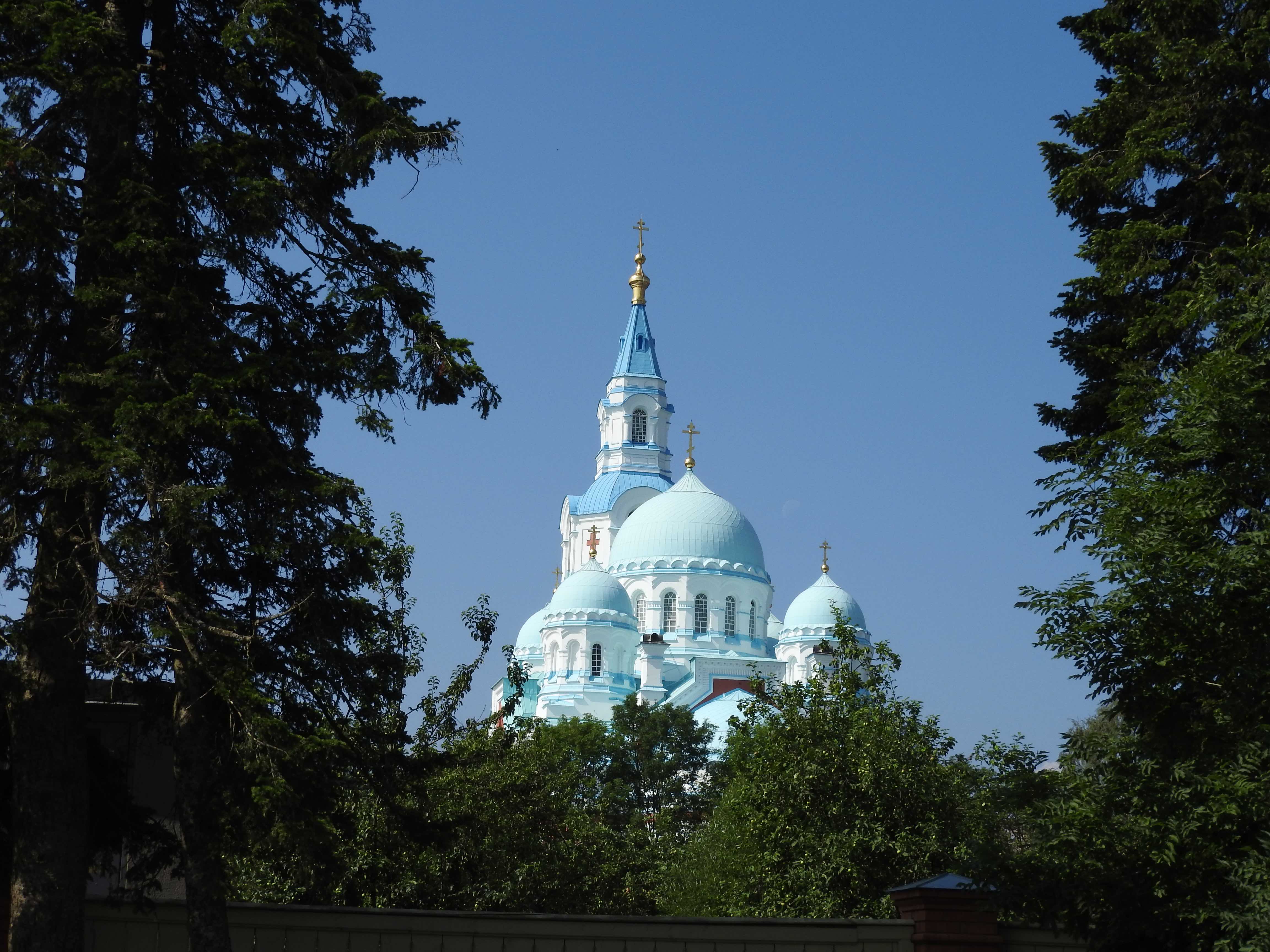
Fig. 11 The church of the Valaam monastery seen from the deck Cérès at anchor.
The light on the evening of our second day at the foot of the monastery was so gorgeous that after an extensive walk on the island we decided to anticipate our departure for the Svir river. Rather than waiting for the next morning, we left as the sun slowly went down above the trees of the forest. The narrow shallow fjord was like a mirror in golden light as we left. We sailed east along the archipelago in the descending darkness, seeing no signs of life on the small islands draped in forests, but a bonfire here and there. We turned south after some hours passing between islands on a straight lit by two lighthouses, aiming south for the mouth of the Svir river some 70NM away. Arriving there the following afternoon, we first found an isolated red and white clear water mark, the low shore barely visible in the distance, and entered a marked channel as little by little a marsh appeared on both sides of the channel. It is only several NM further that trees could be seen and indicated both sides of what had become recognisable as a river. But for a small working ship that had approached the channel as we did, and stopped there in the middle of nowhere, we were completely alone in an infinitely calm landscape.
Our charts indicated what I imagined would be a town or at least a village some miles up the river. I had planned to stop there for the night. But only few scattered houses could be seen, no pier, no quay, no place to tie a boat, be it only for few minutes. The shores were shallow, unsuitable for a sailing boat. We therefore pushed for some more hours, alone on the broad river, now in a thick forest to reach a place marked on the chart as a possible anchoring spot. Nothing there but marshes and forests, no sign of human presence. The current was strong; a fresh breeze blew upstream. Difficult to know whether the wind or the current would win to stabilize Cérès on its anchor and therefore where we would rest once the anchor was dropped. We had to try several times before being reasonably satisfied that Cérès would spend the night safely out of the traffic channel, but far enough from the shore for the water to be deep enough. It was to be a perfect evening with drinks, food, light, warmth, quietness, a passing cargo ship every few hours, the sound of the wind on the nearby reeds. I noted though in the middle of the short night that we were slowly drifting away from where we had stopped in the late afternoon. I therefore stood watch until the morning to ensure that we would not come too close to the shallow and muddy shore. We understood when we lifted the anchor, that it had caught a heavy sunken tree trunk which was bulky enough to to hold us, but not quite massive enough to prevent any drift. Once freed from the trunk we continued motoring up the river in a thick endless forest for the whole day, only seeing here and there a few datchas. Few people were seen on the shore or around the houses, surprisingly they made every effort to avoid noticing the white boat passing by. It was as if anything out of the usual was to be carefully not registered. Only children would make happy signs as we sailed by.
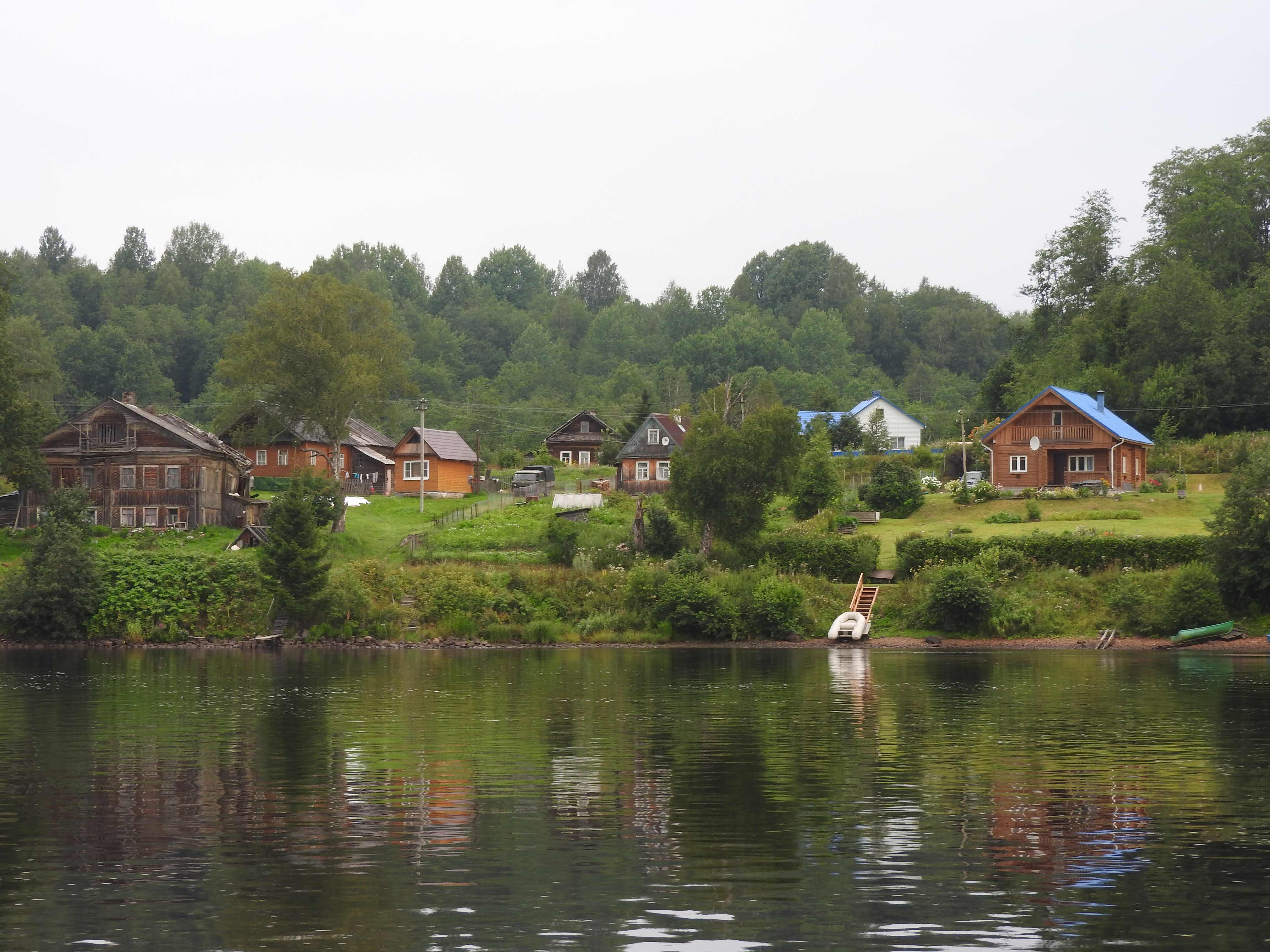
Fig. 12 Datchas along the Svir river
We stopped for another short night at a deserted resort on the shore of the river. After some hesitation, apparently because tourist ships might arrive, we were shown a floating barge along side of which we could tie for the night. Deserted log houses were organised around a large completely empty restaurant where we did have a meal. Stretching our legs after two and a half days on board was a pleasure, even if the surroundings felt like a sterile empty resort for inexistent wealthy Russian tourists.
Another full day of motoring upstream the Svir river in the forest led to another isolated anchoring place in a knee of the river out of the current. A chapel could be seen on the shore and some houses in the distance to and from which a light fast motorboat moved at times. But here as elsewhere nobody approached us and we spent another night in the quiet of the endless Russian forest. It was to be yet another day of motoring up the river before we reached an area where some human activity took place. Old timber industries flanked the river before we reached a lock and a bridge. We were made to wait at anchor in front of the bridge until it was opened and the lock prepared for us. Masha was again in full activity translating and radioing with the various officials dealing with these operations.
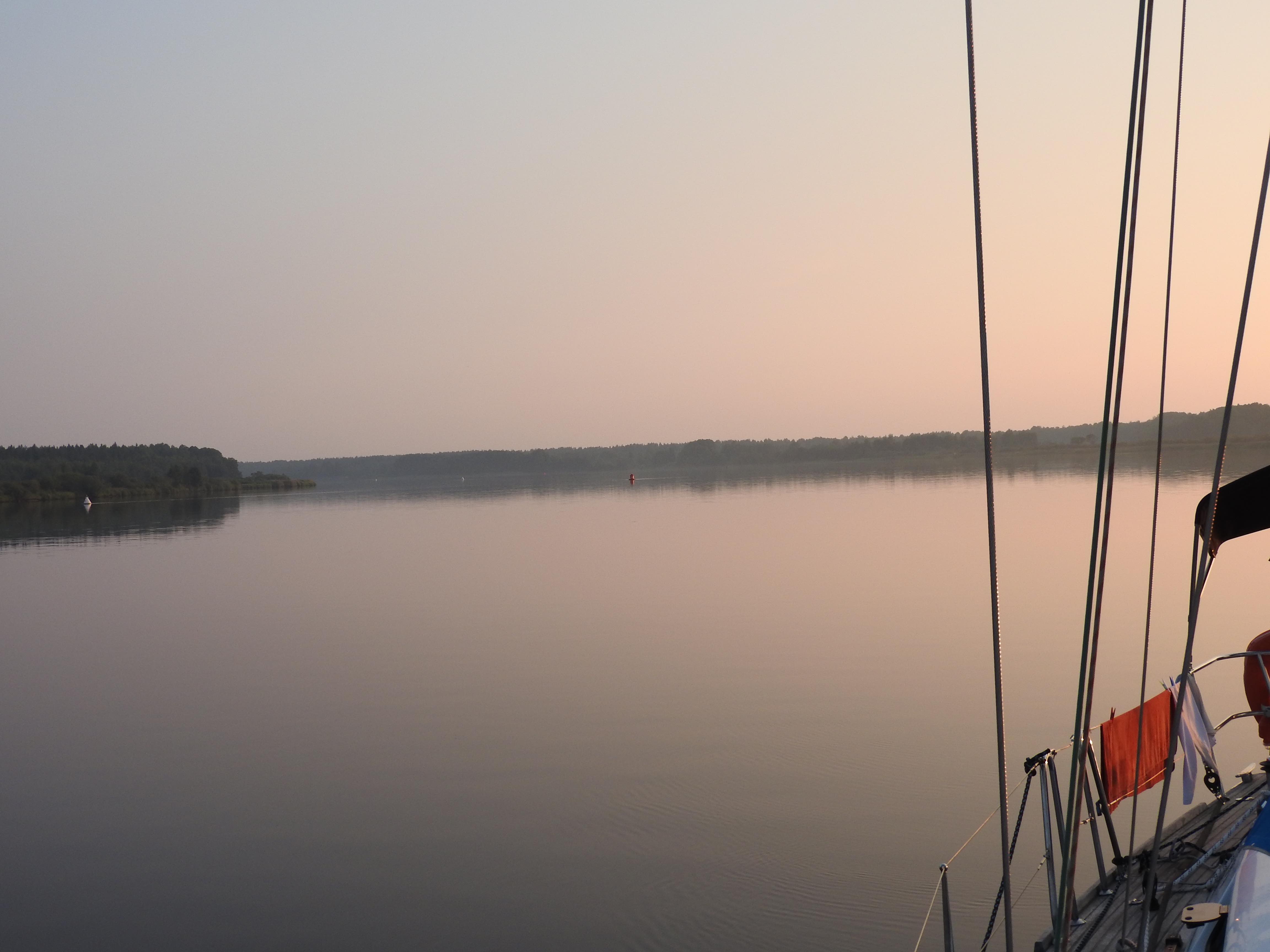
Fig. 13 motoring up the Svir river in the endless Russian forest
Once these obstacles behind another hour or so led us to Voznesenye, where the river exits lake Onega, the second largest lake in Europe. Finding a spot to tie Cérès was worth another round of communication with various officials. We were made to tie alongside two motor boats, which had already seen many years of use, inhabited by elderly men. The boat owners, however, warned us that they would leave in the late afternoon as strong thunderstorms were expected and the place was not sheltered. We were then to tie to the steel half stranded barge with barely enough water under our keel. Waiting for the storm we went to the supermarket, the first since Schlisselburg, a needed stop after many days living off the resources of the board. The elderly men helped us carry our groceries with their by boat, a welcome gesture as the supermarket was quite some ways down the river. When leaving, the two men warned us that whereas we would probably be safe with our boat during the storm, we should watch for groups of young people who use the spot to drink significant amounts of alcohol and could become aggressive. And indeed, as clouds approached, so did some ten or fifteen mostly young people carrying large plastic bottles of a colourless liquid that was most probably not water. Thinking that the best way to deal with the situation was to engage with them, I went on deck, and attempted to start a conversation. But they either did not speak English or did not want to talk with me or some combination of both, so that the dialogue never took off the ground. I went on insisting, however, to the point that after a while they left. The storm did not materialise beyond some wind and rain and we spent a quiet evening and night.
to be continued.